
Tristate Buried: Monster Storm Delivers Foot-Plus Snow
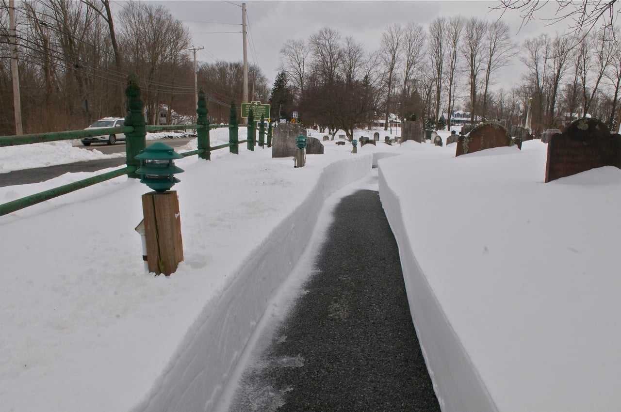
A significant winter storm blanketed the region with heavy snowfall just before dawn on Sunday, January 25th. The National Weather Service has compiled a comprehensive list of snowfall totals from various locations, offering a detailed look at the storm's impact. These figures, reported by official observers, trained spotters, and the public, provide a clear picture of the snow accumulation across New York, New Jersey, and Connecticut. Updates to these totals were expected through Monday, January 26th.
New York Snowfall Totals
New York experienced widespread snowfall, with accumulations varying across its boroughs and counties.
Manhattan: * Central Park: 8.8 inches (Official NWS Observation at 4:15 PM, January 25th)
Queens: * NYC/La Guardia: 9.0 inches (Official NWS Observation at 4:00 PM, January 25th) * NYC/JFK: 8.3 inches (Official NWS Observation at 4:00 PM, January 25th)
Bronx: * W Throgs Neck Bridge: 11.3 inches (Reported by Trained Spotter at 4:16 PM, January 25th)
Brooklyn: * SSE Williamsburg: 10.5 inches (Reported by Public at 4:30 PM, January 25th)
Westchester County: * SSW Goldens Bridge: 12.5 inches (Reported by Trained Spotter at 3:45 PM, January 25th) * SE Hartsdale: 12.5 inches (Reported by Trained Spotter at 3:44 PM, January 25th) * SSW Greenville: 12.3 inches (Reported by Public at 4:32 PM, January 25th) * Bronxville: 11.0 inches (Reported by Public at 4:09 PM, January 25th) * N Port Chester: 11.0 inches (Reported by Public at 4:06 PM, January 25th) * N White Plains: 10.7 inches (Reported by Trained Spotter at 2:30 PM, January 25th) * Mamaroneck: 10.5 inches (Reported by Trained Spotter at 3:45 PM, January 25th) * NNE White Plains: 10.5 inches (Reported by Public at 2:39 PM, January 25th) * NW Woodlawn: 10.2 inches (Reported by Trained Spotter at 2:51 PM, January 25th) * E Pelham Manor: 10.1 inches (Reported by Public at 2:30 PM, January 25th) * Mount Vernon: 10.0 inches (Reported by Trained Spotter at 3:45 PM, January 25th) * ENE Peekskill: 9.8 inches (Reported by Trained Spotter at 3:08 PM, January 25th) * New Rochelle: 9.0 inches (Reported by Trained Spotter at 3:45 PM, January 25th) * N Mamaroneck: 9.0 inches (Reported by Public at 2:48 PM, January 25th) * ESE Hartsdale: 8.5 inches (Reported by Trained Spotter at 2:18 PM, January 25th) * ENE Bedford: 8.1 inches (Reported by Public at 1:28 PM, January 25th) * Somers: 8.0 inches (Reported by Public at 1:30 PM, January 25th)
Nassau County: * ENE Glen Cove: 12.1 inches (Reported by Public at 4:32 PM, January 25th) * ENE North Merrick: 12.1 inches (Reported by Public at 3:50 PM, January 25th) * Locust Valley: 11.5 inches (Reported by Public at 2:15 PM, January 25th) * SE Malverne: 10.5 inches (Reported by Cocorahs at 3:15 PM, January 25th) * SW Elmont: 10.2 inches (Reported by Trained Spotter at 4:00 PM, January 25th) * N Syosset: 10.1 inches (Reported by Trained Spotter at 2:30 PM, January 25th) * ENE Bethpage: 10.0 inches (Reported by Public at 4:00 PM, January 25th) * East Williston: 9.8 inches (Reported by Public at 3:50 PM, January 25th) * N Levittown: 9.5 inches (Reported by Public at 2:02 PM, January 25th) * ENE East Meadow: 9.2 inches (Reported by Emergency Manager at 4:13 PM, January 25th) * Matinecock: 9.2 inches (Reported by Public at 12:45 PM, January 25th) * W Westbury: 9.0 inches (Reported by Amateur Radio at 2:31 PM, January 25th) * SSW Baldwin: 9.0 inches (Reported by Public at 1:58 PM, January 25th) * NNE Franklin Square: 8.8 inches (Reported by Public at 2:02 PM, January 25th) * WSW Levittown: 8.6 inches (Reported by NWS Employee at 2:25 PM, January 25th) * East Meadow: 8.5 inches (Reported by NWS Employee at 2:27 PM, January 25th) * ESE Jericho: 8.2 inches (Reported by Trained Spotter at 2:33 PM, January 25th) * NW Levittown: 8.1 inches (Reported by Public at 4:15 PM, January 25th) * Lynbrook: 8.0 inches (Reported by Amateur Radio at 2:35 PM, January 25th) * E East Meadow: 8.0 inches (Reported by Public at 1:39 PM, January 25th) * Baldwin: 7.8 inches (Reported by Public at 2:20 PM, January 25th) * NW Hewlett: 7.5 inches (Reported by Public at 2:09 PM, January 25th) * SSE Bellmore: 7.3 inches (Reported by Public at 2:13 PM, January 25th) * SSW Manhasset Hills: 7.0 inches (Reported by Amateur Radio at 2:10 PM, January 25th) * SW Matinecock: 7.0 inches (Reported by Public at 12:33 PM, January 25th) * NW Bethpage: 6.5 inches (Reported by Public at 1:20 PM, January 25th) * Seaford: 3.0 inches (Reported by Public at 12:34 PM, January 25th)
Suffolk County: * SSE Northport: 11.5 inches (Reported by Trained Spotter at 3:45 PM, January 25th) * S Centerport: 11.3 inches (Reported by CO-OP Observer at 4:16 PM, January 25th) * ENE Sag Harbor: 11.2 inches (Reported by Public at 4:35 PM, January 25th) * Islip Airport: 11.2 inches (Official NWS Observation at 4:00 PM, January 25th) * SE East Northport: 10.5 inches (Reported by Public at 3:45 PM, January 25th) * SW Poquott: 10.1 inches (Reported by NWS Employee at 4:09 PM, January 25th) * Copiague: 10.0 inches (Reported by Trained Spotter at 3:30 PM, January 25th) * SW East Northport: 10.0 inches (Reported by Trained Spotter at 3:05 PM, January 25th) * SSW Miller Place: 10.0 inches (Reported by NWS Employee at 3:00 PM, January 25th) * S Commack: 9.7 inches (Reported by Public at 4:08 PM, January 25th) * W Nesconset: 9.6 inches (Reported by Public at 4:11 PM, January 25th) * W Shirley Airport: 9.5 inches (Reported by Public at 4:15 PM, January 25th) * Deer Park: 9.5 inches (Reported by Trained Spotter at 2:55 PM, January 25th) * WNW Riverhead: 9.4 inches (Reported by NWS Employee at 3:52 PM, January 25th) * ENE Commack: 9.0 inches (Reported by Broadcast Media at 4:00 PM, January 25th) * Stony Brook: 8.9 inches (Reported by NWS Employee at 2:54 PM, January 25th) * ENE Ridge: 8.5 inches (Reported by Trained Spotter at 3:30 PM, January 25th) * S Nissequogue: 8.3 inches (Reported by Public at 3:37 PM, January 25th) * SSE Coram: 8.2 inches (Reported by Trained Spotter at 3:55 PM, January 25th) * East Islip: 8.2 inches (Reported by Public at 3:26 PM, January 25th) * N Springs: 8.0 inches (Reported by Public at 3:01 PM, January 25th) * South Huntington: 8.0 inches (Reported by Broadcast Media at 2:39 PM, January 25th) * ENE Commack: 8.0 inches (Reported by Broadcast Media at 2:26 PM, January 25th) * ESE East Patchogue: 7.8 inches (Reported by Public at 3:17 PM, January 25th) * Upton (NWS Office): 7.8 inches (Official NWS Observation at 3:17 PM, January 25th) * Blue Point: 7.8 inches (Reported by Cocorahs at 2:30 PM, January 25th) * SE Ridge: 7.6 inches (Reported by NWS Employee at 2:50 PM, January 25th) * WSW East Islip: 7.5 inches (Reported by Public at 4:20 PM, January 25th) * Sayville: 7.5 inches (Reported by Public at 3:30 PM, January 25th) * ENE Orient: 7.5 inches (Reported by Fire Dept/Rescue at 2:58 PM, January 25th) * Mattituck: 7.3 inches (Reported by Trained Spotter at 1:45 PM, January 25th) * N North Bellport: 7.1 inches (Reported by Trained Spotter at 2:09 PM, January 25th) * WNW Jamesport: 7.0 inches (Reported by Public at 3:59 PM, January 25th) * NNW Remsenburg-Speonk: 7.0 inches (Reported by Public at 3:03 PM, January 25th) * Islip: 7.0 inches (Reported by Public at 2:15 PM, January 25th) * NNW Ronkonkoma: 7.0 inches (Reported by Public at 2:05 PM, January 25th) * Huntington Station: 7.0 inches (Reported by Trained Spotter at 1:35 PM, January 25th) * SW Amityville: 7.0 inches (Reported by Public at 12:30 PM, January 25th) * S Sayville: 6.9 inches (Reported by NWS Employee at 3:00 PM, January 25th) * West Islip: 6.8 inches (Reported by Trained Spotter at 2:45 PM, January 25th) * W Hauppauge: 6.0 inches (Reported by Trained Spotter at 12:40 PM, January 25th) * Islip Airport: 5.8 inches (Official NWS Observation at 1:00 PM, January 25th)
Orange County: * Salisbury Mills: 13.0 inches (Reported by Trained Spotter at 3:00 PM, January 25th) * E Highland Mills: 12.3 inches (Reported by Public at 4:31 PM, January 25th) * Florida: 12.0 inches (Reported by Amateur Radio at 3:50 PM, January 25th) * Monroe: 12.0 inches (Reported by Trained Spotter at 3:40 PM, January 25th) * SSW Middletown: 11.8 inches (Reported by Fire Dept/Rescue at 3:45 PM, January 25th) * New Windsor: 11.2 inches (Reported by Trained Spotter at 3:06 PM, January 25th) * Middletown: 10.6 inches (Reported by Public at 4:00 PM, January 25th) * Chester: 10.5 inches (Reported by Trained Spotter at 2:00 PM, January 25th) * Walden: 10.0 inches (Reported by Amateur Radio at 2:44 PM, January 25th) * WNW Warwick: 10.0 inches (Reported by Trained Spotter at 2:12 PM, January 25th) * NNW Kiryas Joel: 9.5 inches (Reported by Amateur Radio at 3:06 PM, January 25th) * Montgomery: 9.5 inches (Reported by Amateur Radio at 3:03 PM, January 25th) * SSW Stewart Airport: 9.3 inches (Reported by Public at 3:27 PM, January 25th) * Warwick: 9.3 inches (Reported by Amateur Radio at 2:07 PM, January 25th) * Mount Hope: 9.0 inches (Reported by Trained Spotter at 1:31 PM, January 25th) * Highland Mills: 8.3 inches (Reported by Amateur Radio at 2:05 PM, January 25th) * Newburgh: 7.0 inches (Reported by Trained Spotter at 1:30 PM, January 25th) * NW Firthcliffe: 7.0 inches (Reported by Trained Spotter at 1:00 PM, January 25th) * NNE Chester: 7.0 inches (Reported by Public at 12:28 PM, January 25th) * SSW Pine Bush: 6.0 inches (Reported by Public at 12:54 PM, January 25th)
Putnam County: * Mahopac: 9.5 inches (Reported by Amateur Radio at 3:30 PM, January 25th) * N Putnam Valley: 7.9 inches (Reported by Broadcast Media at 2:10 PM, January 25th) * W Putnam Valley: 7.3 inches (Reported by Trained Spotter at 1:15 PM, January 25th)
Rockland County: * Thiells: 13.5 inches (Reported by Trained Spotter at 4:00 PM, January 25th) * Monsey: 13.0 inches (Reported by Public at 3:56 PM, January 25th) * Ramapo: 12.5 inches (Reported by Trained Spotter at 3:45 PM, January 25th) * SE Montebello: 12.5 inches (Reported by Public at 3:37 PM, January 25th) * ENE Congers: 11.5 inches (Reported by Public at 4:53 PM, January 25th) * SSW Congers: 11.5 inches (Reported by Trained Spotter at 2:15 PM, January 25th) * New City: 11.1 inches (Reported by Trained Spotter at 3:10 PM, January 25th) * Valley Cottage: 11.0 inches (Reported by Trained Spotter at 4:20 PM, January 25th) * Stony Point: 10.0 inches (Reported by Trained Spotter at 1:33 PM, January 25th) * NW Stony Point: 10.0 inches (Reported by Public at 1:25 PM, January 25th) * Suffern: 8.5 inches (Reported by Emergency Manager at 12:29 PM, January 25th) * Nyack: 8.2 inches (Reported by Trained Spotter at 2:00 PM, January 25th)
New Jersey Snowfall Totals
New Jersey also experienced substantial snowfall, particularly in its northern counties.
Bergen County: * Ridgefield: 12.0 inches (Reported by Public at 4:04 PM, January 25th) * NNE Franklin Lakes: 11.8 inches (Reported by Trained Spotter at 4:43 PM, January 25th) * N River Vale: 11.0 inches (Reported by Trained Spotter at 4:00 PM, January 25th) * Montvale: 11.0 inches (Reported by Trained Spotter at 3:35 PM, January 25th) * NE Upper Saddle River: 11.0 inches (Reported by Public at 3:06 PM, January 25th) * Leonia: 11.0 inches (Reported by Public at 3:01 PM, January 25th) * NNW Cliffside Park: 10.2 inches (Reported by Public at 2:07 PM, January 25th) * ENE Park Ridge: 10.0 inches (Reported by Trained Spotter at 2:46 PM, January 25th) * NNW Rutherford: 10.0 inches (Reported by C-Man Station at 2:41 PM, January 25th) * SE Fair Lawn: 9.7 inches (Reported by Public at 2:25 PM, January 25th) * SSW River Edge: 9.6 inches (Reported by Cocorahs at 3:30 PM, January 25th) * WSW Wallington: 9.5 inches (Reported by Trained Spotter at 3:23 PM, January 25th) * NNE Bergenfield: 9.4 inches (Reported by Trained Spotter at 2:43 PM, January 25th) * Park Ridge: 9.1 inches (Reported by Broadcast Media at 2:00 PM, January 25th) * ESE Nutley: 9.0 inches (Reported by Cocorahs at 3:00 PM, January 25th) * Westwood: 9.0 inches (Reported by Public at 1:49 PM, January 25th) * Mahwah: 9.0 inches (Reported by Trained Spotter at 1:41 PM, January 25th) * Fair Lawn: 8.5 inches (Reported by Trained Spotter at 3:32 PM, January 25th) * Wood-Ridge: 8.5 inches (Reported by Public at 2:45 PM, January 25th) * NE Ridgefield: 6.5 inches (Reported by Public at 12:50 PM, January 25th)
Essex County: * NW Newark: 10.0 inches (Reported by Public at 3:59 PM, January 25th) * SW North Caldwell: 10.0 inches (Reported by Public at 2:56 PM, January 25th) * W North Caldwell: 9.5 inches (Reported by Cocorahs at 3:00 PM, January 25th) * SSE Belleville: 9.5 inches (Reported by Public at 2:31 PM, January 25th) * NE North Caldwell: 9.4 inches (Reported by Public at 2:57 PM, January 25th) * E North Caldwell: 9.4 inches (Reported by Amateur Radio at 1:23 PM, January 25th) * SSE Nutley: 9.0 inches (Reported by Public at 4:34 PM, January 25th) * SE Montclair: 9.0 inches (Reported by Public at 2:20 PM, January 25th) * SSW West Orange: 8.5 inches (Reported by Public at 2:00 PM, January 25th) * WSW Glen Ridge: 8.0 inches (Reported by Public at 2:00 PM, January 25th) * NE Montclair: 8.0 inches (Reported by Public at 1:30 PM, January 25th) * WNW Bloomfield: 8.0 inches (Reported by Public at 1:20 PM, January 25th) * SE Millburn: 6.8 inches (Reported by Public at 1:20 PM, January 25th) * NW Orange: 6.7 inches (Reported by Public at 2:04 PM, January 25th)
Hudson County: * Harrison: 9.5 inches (Reported by CO-OP Observer at 4:13 PM, January 25th) * Hoboken: 8.0 inches (Reported by Trained Spotter at 2:00 PM, January 25th) * W Hoboken: 7.1 inches (Reported by Trained Spotter at 2:14 PM, January 25th) * ENE Jersey City: 7.1 inches (Reported by Public at 1:07 PM, January 25th) * Kearny: 6.5 inches (Reported by Trained Spotter at 1:30 PM, January 25th)
Passaic County: * NE Wayne: 12.0 inches (Reported by Public at 2:35 PM, January 25th) * S Pompton Lakes: 9.5 inches (Reported by Trained Spotter at 1:46 PM, January 25th)
Union County: * WNW Berkeley Heights: 10.0 inches (Reported by Public at 2:46 PM, January 25th) * Newark Airport: 9.8 inches (Official NWS Observation at 4:00 PM, January 25th) * Linden: 9.6 inches (Reported by Broadcast Media at 4:38 PM, January 25th) * Cranford: 9.0 inches (Reported by Trained Spotter at 2:37 PM, January 25th) * NE Union: 8.8 inches (Reported by Public at 3:49 PM, January 25th) * WNW Elizabeth: 8.5 inches (Reported by Public at 2:23 PM, January 25th) * SSW Westfield: 7.7 inches (Reported by Public at 12:32 PM, January 25th)
Connecticut Snowfall Totals
Connecticut also saw considerable snowfall, impacting its coastal and inland areas.
Fairfield County: * Bridgeport Airport: 13.0 inches (Official NWS Observation at 4:15 PM, January 25th) * SE Norwalk: 11.3 inches (Reported by Public at 3:04 PM, January 25th) * ENE Monroe: 11.0 inches (Reported by Trained Spotter at 4:30 PM, January 25th) * NNW New Fairfield: 11.0 inches (Reported by Trained Spotter at 3:58 PM, January 25th) * S Greenwich: 10.7 inches (Reported by Public at 4:04 PM, January 25th) * S New Canaan: 9.8 inches (Reported by Public at 2:35 PM, January 25th) * E Norwalk: 9.5 inches (Reported by Public at 2:01 PM, January 25th) * SSE Easton: 9.0 inches (Reported by Public at 4:07 PM, January 25th) * Bethel: 9.0 inches (Reported by Emergency Manager at 3:31 PM, January 25th) * Shelton: 9.0 inches (Reported by Trained Spotter at 2:00 PM, January 25th) * SW Newtown: 8.8 inches (Reported by Amateur Radio at 3:05 PM, January 25th) * Greenwich: 8.5 inches (Reported by Public at 2:02 PM, January 25th) * SSE Weston: 8.1 inches (Reported by Trained Spotter at 2:26 PM, January 25th) * N Stamford: 8.0 inches (Reported by Cocorahs at 2:06 PM, January 25th) * ENE New Canaan: 7.0 inches (Reported by Trained Spotter at 1:09 PM, January 25th) * ENE Redding: 5.9 inches (Reported by Public at 2:15 PM, January 25th) * WSW Shelton: 5.0 inches (Reported by Trained Spotter at 12:30 PM, January 25th)
Middlesex County: * NW Saybrook Manor: 10.8 inches (Reported by Public at 4:01 PM, January 25th) * SW Westbrook: 10.0 inches (Reported by Trained Spotter at 4:36 PM, January 25th) * NNW Durham: 8.0 inches (Reported by Public at 3:15 PM, January 25th) * NW Cromwell: 6.5 inches (Reported by Public at 2:49 PM, January 25th) * NNE Middletown: 6.0 inches (Reported by Public at 2:10 PM, January 25th) * Durham: 6.0 inches (Reported by Trained Spotter at 2:00 PM, January 25th) * Clinton: 5.6 inches (Reported by Broadcast Media at 1:50 PM, January 25th) * Killingworth: 4.5 inches (Reported by Trained Spotter at 2:00 PM, January 25th)
New Haven County: * West Haven: 12.0 inches (Reported by Trained Spotter at 3:45 PM, January 25th) * NW Ansonia: 10.1 inches (Reported by Public at 3:53 PM, January 25th) * Guilford: 10.0 inches (Reported by CO-OP Observer at 4:00 PM, January 25th) * ENE Branford: 10.0 inches (Reported by Public at 3:55 PM, January 25th) * ENE North Haven: 8.8 inches (Reported by Trained Spotter at 3:19 PM, January 25th) * ESE Stratford: 8.2 inches (Reported by Public at 2:13 PM, January 25th) * ESE West Haven: 7.0 inches (Reported by Public at 2:32 PM, January 25th) * Milford: 7.0 inches (Reported by Trained Spotter at 2:00 PM, January 25th) * Naugatuck: 7.0 inches (Reported by Trained Spotter at 2:00 PM, January 25th) * Wallingford: 7.0 inches (Reported by Trained Spotter at 2:00 PM, January 25th) * Hamden: 6.0 inches (Reported by Trained Spotter at 2:00 PM, January 25th) * Meriden: 5.8 inches (Reported by Public at 2:10 PM, January 25th) * Madison: 5.3 inches (Reported by Trained Spotter at 1:00 PM, January 25th) * North Madison: 5.0 inches (Reported by Emergency Manager at 1:06 PM, January 25th)
New London County: * Groton: 6.5 inches (Reported by Broadcast Media at 3:00 PM, January 25th) * SSE Ledyard Center: 5.5 inches (Reported by Trained Spotter at 3:00 PM, January 25th) * Norwich: 5.1 inches (Reported by Cocorahs at 2:00 PM, January 25th) * Niantic: 5.0 inches (Reported by Amateur Radio at 2:30 PM, January 25th) * SSE Gales Ferry: 4.0 inches (Reported by Public at 1:44 PM, January 25th)
Post a Comment for "Tristate Buried: Monster Storm Delivers Foot-Plus Snow"